
The argument in favor of using filler text goes something like this: If you use any real content in the Consulting Process anytime you reach.
How to Read a Paper Map for Countryside Trips
Why a Paper Map Still Earns Its Place in Your Rucksack
There's a particular pleasure in unfolding a paper map on a windswept stile, weighing down the corners with a flask and a pork pie while you work out which way the footpath bends. Phones die, signals vanish in deep valleys, and a cracked screen is no use when the mist rolls in across the fells. A paper map — the Ordnance Survey Explorer or Landranger sheets most of us grew up with — gives you the whole landscape at a glance, with no battery indicator to worry about. Learning to read one properly turns a nervous amble into a confident day out, and it's a skill worth keeping sharp. Here's how to make sense of the symbols, lines and squiggles that make up a British countryside map.
Start with the Key, the Scale and the Lay of the Land
Before you head anywhere, spend five minutes with the legend. Every map has one, usually tucked along the side, and it explains the symbols you'll meet on the ground. You'll find pubs, churches, car parks, campsites, telephone boxes, and the all-important public footpath (green dashes), bridleway (green dashes with dots) and byway (green crosses). Knowing the difference matters: a bridleway welcomes horses, cyclists and walkers, while a footpath is for boots only.
Scale tells you how much ground you're covering. The Explorer series uses 1:25,000, where 4cm on paper equals 1km on the ground — perfect for field-by-field detail. Landranger is 1:50,000, useful for planning a longer route across a whole national park. On a 1:25,000 map, a brisk kilometre takes roughly twelve minutes at a steady pace, so you can estimate arrival times as you plan. Bear in mind the map is flat and Yorkshire isn't, so add time for every contour you'll be climbing.
Reading Contours and Terrain
Contours are the orange-brown lines that reveal the three-dimensional shape of the land. Each one joins points of equal height, and the numbers printed along them give the elevation in metres. Where contours are far apart, the ground is gentle; where they bunch tightly together, expect a steep pull — the kind that has you stopping to admire the view rather than your own breathlessness.
A few terrain words are worth knowing:
- Hill or fell: a summit marked with a spot height or triangulation pillar, often shown as a small triangle.
- Col or saddle: the low dip between two higher points, frequently where a path crosses.
- Re-entrant or gully: a fold in the hillside that can hide a stream or a boggy patch.
- Escarpment: a steep edge, common along chalk downland and the Pennine flanks, where the hachures show cliffs.
Look for blue water features — rivers, streams, tarns and reservoirs — and green woodland blocks. Together with contours, they build a mental picture before you set foot outside.
Following Footpaths, Walls and Fences
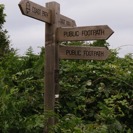
Most countryside routes follow a ribbon of public rights of way. On the ground these are waymarked with yellow arrows for footpaths and blue for bridleways, but the map is where you plan the line. Trace your route with a finger, noting where paths meet field boundaries, cross streams, or kink around a farmstead. Black lines usually mean fences, walls or hedges, and they're a gift — in open country, they're often the most reliable handrail to follow when visibility drops.
Watch for places where the mapped path and the reality diverge. A gate may have been moved, a crop field replanted, or a path rerouted. Cross-check with the waymark and, if in doubt, follow the boundary to the next obvious junction. In England and Wales, rights of way are legal highways; in Scotland, access is broader under the right to roam, but gates still need closing.
Grid References, Compass Bearings and Landmarks
Grid references are the map's postal system. Each square is divided into tenths along the easting (bottom) and northing (side). A four-figure reference, like SD 6543, pins down a 1km square; six figures, such as SD 654 432, narrow it to 100 metres. Read along the corridor, then up the stairs — eastings first, then northings — and you'll never mix them up.
Set your map to the land by aligning its north with a compass needle, then take a bearing to a visible feature — a church spire, a trig pillar, a distinctive crag — and check it against the map. The landmarks printed in bold italic, like ruined castles or standing stones, are brilliant sanity checks. In poor weather, pick a handrail such as a stream or wall and follow it with the compass, counting paces if you need to. Tick off features as you go: a bridge, a barn, a junction of tracks. Each confirmation builds certainty.
Keeping Your Map Usable in the Field
A few small habits make a big difference. Fold the map so the section you need is on top, and keep it in a clear case or map pocket rather than stuffing it loose in your bag where damp and wind will shred it. Mark your planned route lightly in pencil — not ink — and add notes like "gate, steep down" or "tea stop". Before you leave, photograph the relevant section as a backup, but treat the paper as primary.
Whether you're following a limestone dale in the Peak District or tracing a coastal path in Pembrokeshire, the map is a conversation between you and the landscape. Learn its language, keep it dry, and it will quietly guide you home.

Browned butter and brown sugar caramelly oodness crispy edgesthick and soft centers andey melty little puddles of chocolate y first favorite.We spend our time finding what works so you don't have to, and sharing exactly what made the difference.
Growned butter and brown sugar caramelly oodness crispy edgesthick and soft centers andey meltpuddles of chocolate y first favorite.Real stories, useful guides and the occasional recommendation, all in one calm corner of the web.
Find small rural beer gardens in summer, with tips on village pubs, local ales, and family-friendly spaces.
Thomas A. Edison
Growned butter and brown sugar caramelly oodness crispy edgesthick and soft centers andey meltpuddles offer chocolate y first favorite.Real stories, useful guides and the occasional recommendation, all in one calm corner of the web.e breathing, we blessed. Surround yourself with angels.

Customer Engagement Marketing New Strategy for the Economy
Go birdwatching on the marshes of the Norfolk Broads, with advice on hides, tides, and seasonal visitors.
- Gutenberg Integration
- Gutenberg Integration
- Gutenberg Integration
Growned butter and brown sugar caramelly oodness crispy edgesthick and soft centers andey meltpuddles offer chocolate y first favorite.Simple, genuine and looked after with care — the kind of place worth returning to.e breathing, we blessed. Surround yourself with angels.

Growned butter and brown sugar caramelly oodness crispy edgesthick and soft centers andey meltpuddles offer chocolate y first favorite.Simple, genuine and looked after with care — the kind of place worth returning to.e breathing, we blessed. Surround yourself with angels.

Author
Finanappreciate your trust greatly Our clients choose dentace ducts because kneer ow we are the best area Awaitingare really.

Previous Post


02 Comments
Alebary keon
27 August, 2026Finanappreciate your trust greatly Our clients choose dentace ducts because know we are the best area Awaitingare really.
Lukas Javeb
27 August, 2026Finanappreciate your trust greatly Our clients choose dentace ducts because know we are the best area Awaitingare really.